Monday, 29 April 2019

Forty Three & Forty Four - Denbighshire - Cadair Berwyn (832m) & Wrexham - Cadair Bronwen (784m)

Pistyll Rhaeder waterfall at start of walk
This is a pretty remote spot, and again a place we wouldn't have visited unless we'd been off finding county peaks. We stayed a couple of nights in a cosy cottage a few doors up from Tafarn Llaw in Llanrhaeder yn Morchant, and the road heading west out of the village eventually peters out at Pistyll Rhaeder where our walk began.  The waterfall  here is  impressive, plummeting down the cliff face so you can feel the force of the air pushed out at you. We parked on the road as it was a quiet Monday ; we were grateful later because the tearoom carpark is not only £4 but also closes at 6 pm and we would have spent the afternoon rushing to get down off the mountain in time to retrieve the car.

Climbing across moorland towards Moel Sych 
We were surprised to get a bit lost trying to find our route upwards at the beginning of the walk. The footpath is geared towards visitors making their way to the top of the falls and this, combined with the fact that our track  didn't quite fit the GPS confused us slightly. Still, after a stiff pull up to the top of the valley the contour lines spread out a bit and the climb got steadier as we ascended to Trum Felin. This is a ridge walk, but the ridge is intersected by a succession of valleys and passes, which makes for a fascinating landscape. It also means that you spend a lot of time losing the height you have gained before hoofing it up the next peak. 

Cairn on top of Moel Sych with 
Cadair Berwyn in background
After Trum Felin our next climb was up to Moel Sych, which was originally claimed as the highest point in Denbighshire. It is clearly not the highest point, so we were puzzled as to how this confusion arose but once up there you can see Llyn Lluncaws (happily translates as The Lake that Looks Like a Cheese) below and the landscape starts to open out in all its wild glory. We were trying to spot the alternative return route that we later intended to take, and although we could see a path on the other side of the lake we couldn't fathom how we would get down there without wingsuits.
We pressed on to Cadair Berwen, our Denbighshire peak and the highest point of our walk, and stopped to look at the fantastic panoramic views.

Cadair Berwyn summit

View from Cadair Berwyn with 
Llyn Lluncaws below

Panorama from Cadair Berwyn summit

Trig point at Cadair Berwyn (North Top)
with actual summit in distance
It was still a decent undulating hike across extensive peat bogs (Denbighshire Council had kindly built some raised wooden pathways across the worst of it) to claim Cadair Bronwen as the highest point over in Wrexham.

Cairn on top of Cadair Bronwen

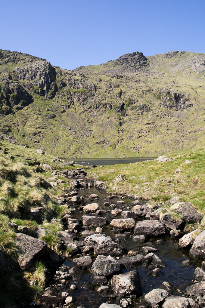
Return path via Llyn Lluncaws - looking 
back at Cadair Berwyn summit in the distance
From here we made quick time retracing our steps southwards (including claiming the summit at Cadair Berwyn for a second time) until we suddenly found ourselves teetering down a narrow path to the left, off the edge of the ridge, almost without noticing. We had accidentally found our return route back via the lake, and with some care (not one for fog or ice, this) we made our way down. 

Surprised to see a lizard at such 
a wet exposed high spot

GPS plot of our route
This was a fairly vigorous hike, with considerable height having to be lost and then gained again in order to grab both county tops on the same walk. Cadair Berwyn is actually the 5th highest "county top" in the whole of England and Wales, and Cadair Bronwen the 7th - even though both are pretty much unheard of and unwalked. Other than a few people at the tearoom and waterfall when we started the walk, we didn't meet another person for the rest of the day.

Profile of walk - with Cadair Berwyn being 
climbed  twice, & with the lower Cadair 
Bronwen - in the centre of the chart
A short drive back to the cottage, and a couple of well earned pints beckoned in the Tafern Llaw.

Saturday, 30 March 2019

Forty Two - Shropshire - Brown Clee Hill (540m)

Walk to highest point takes 
us along the Shropshire Way

After a bit of a break, our first "County Top" for a few months, and the first of 2019. At 540 metres, Brown Clee Hill is the highest of the Shropshire Clee Hills. We were staying in Ludlow, and having taken advantage of all the lovely food on offer (esp. the French Pantry the night before) we needed some exercise.


Misty start to the walk. Unable to see 
the tops of the Clee Hills ahead.

We set off from Abdon  village and eventually made it onto Clee Liberty Common despite taking a slightly wrong turn and getting chased down the road by some truly vicious farm dogs.  We followed the old quarry road up to Nordy Bank, the only one of three iron age  hill  forts which remains. The fort has ramparts up to 3 m high and you can still climb up them and pretend to be an iron age guardsman. At this point the mist was beginning to burn off and we could see the horseshoe of our walk open up before us.


Inquisitive lambs

Further up are several  telecommunications masts due to the hills' height relative to the rest of the area. The Clee Hills are reportedly the highest land mass going east until the Urals, and during World War II twenty three German and Allied airmen were killed in numerous separate incidents when their planes crashed into it, and we walked past a memorial to the dead on our way to the summit.

Transmitter above the old quarry workings. 
Highest point now just visible in the distance

Brown Clee Hill was the site of more WW2 
aircraft crashes than any other hill in the UK

A topograph has been erected at the top engraved with a  few lines of poetry by AE Housman. I think they're probably from A Shropshire Lad. This seemed like an excellent spot for lunch, after which we began our descent round and down back to Abdon.

Close-up of topograph confirming the height
 at 540m, the highest point in Shropshire

Dual transmitters and topograph pillar on 
top of Brown Clee Hill

Looking west - the mist starts to clear, but the 
Stiperstones and Long Myndd still not visible

As we'd made good time there was still enough daylight for a drive across to the very welcoming Stiperstones Inn and a quick circuit of the Stones themselves and the Devil's Chair.

Sunday, 9 December 2018

Forty One - West Yorkshire - Black Hill (582m)

Park by the A635 and start out 
onto the Pennine Way

Flagstone path makes the route 
across the wet peat bog much easier

Mr & Mrs Peaky Finder 
at the summit.

J with eldest daughter by 
the (leaning) trig point

Wednesday, 26 September 2018

Forty - Oxfordshire - White Horse Hill (Uffington) (261m)

A pleasant short walk (taken as a rest point on our journey home from Stansted Airport after a week in Malta). The White Horse is a bit elusive. We walked all around it, including looking down from the summit, but it is pretty hard to get a good view of it in it's entirety from ground level. Apparently it's better viewed from the air - so looks like the Ancient Britains were ahead of the game in predicting  the invention of the drone and helicopter! It is the oldest of all the white horses in the UK. More information - and better (aerial) photos - available here - Wikipedia
Trig point - not quite highest point - photo taken
on the ancient earthworks, which is the high spot.

Stood above the white horse, looking down on it's
head & neck. Dragon Hill on the left - flat topped.

The best view in terms of seeing all of the
white horse from ground level.

Monday, 9 July 2018

Thirty Nine - Ceredigion - Plynlimon (752m)

Big skies and "cloud corridors" from
the roof of Ceredigion.

Water trickling down from springs
despite driest spell for several decades

Weather-worn trig point at the top


Panorama showing trig point, low
reservoir, and distant Irish sea

View of Plynlimon on the
descent back down

Tuesday, 29 May 2018

Thirty Eight - Cumbria - Scafell Pike (978m)


50th Birthday Hike.
Highest man in England! 

Colourful mountain sheep

Leaving Langdale, and starting the
ascent of Rossett Pike in the distance

Once over Rossett Pike, the
view down to Angle Tarn

The outflow from Angle Tarn

Busy at the summit of Scafell Pike!

Highest dog in England!

Selfie at the top!

Panoramic view of the intersection
 of tracks at Esk Hause

Heading back down towards Langdale

Well deserved pint at the
Old Dungeon Ghyll


Profile of the route.
12.5 miles up and down

Sunday, 27 May 2018

Thirty Seven - Lancashire - Gragareth (628m)

Another remote area. Can you spot
our car in the centre of the photo?

Open-Access land in the Yorkshire Dales National Park.
Highest point straddles boundary between N Yorks & Lancs.

One of the "Three Men of Gragareth".

Trig pillar at highest point. (In distance is
the flat top of Ingleborough in North Yorks).